SHR Emblem

SHR Emblem

Tuesday, August 25, 2015

Tuolumne Meadows to Mammoth with Pictures

After getting lost and having a really intense and scary experience on Sky Pilot Col, I took the rest of the day off once I made it to Tuolumne Meadows (Random aside:  The day I arrived was the first day the campground was open after they closed because 2 squirrels died of the plague there).  I relaxes, hung out, and gave my legs a break because they needed it.  I also decided not to continue with the Sierra High Route because it was just over my comfort level being by myself.

What I had experienced three days prior and on two prior off-trial weekend trips was not what I wanted to do.  There were a lot of little reasons (my knees and ankles were getting pretty beat up, the traction on my shoes was essentially worn down, smoke from a fire in Sequoia NP made sighting off the next canyon very difficult at times) but my main reason was because I wasn't enjoying myself.  I found out that a trip like this is something I need to do with at least one other person.  The mental aspect part of the hike wore me down and I didn't want to make bad decisions when I was tired.

This means that I am going to take the John Muir Trail (JMT), and maybe one short manageable section of the Sierra High Route, from Mammoth to Horseshoe Meadows near Lone Pine.  To get to Mammoth, I took a 60 mile half circle that started in Toulumne Meadows, went through Vogelsang area of Yosemite, down to Isberg Pass, and then through the Sierra National Forest to Devil's Postpile National Monument, which is right outside Mammoth.

I chose this route on a whim and it was tough because it was hot and didn't have a lot of running water sources.  I went through parts of Yosemite I had never been through but once I got away from Vogelsang, the trail was pretty boring, especially considering that I was in the Sierra Nevada.

I meet a Canadian couple about a day out from Mammoth and realized how little water there was in the area.  They did their research and found that there was a good chance that we would have only one water sources in the last 20 miles (this ended up not being true but this is how we had to treat the last 20 miles).  As a result, I down 4 liters of water in about 2 hours and then carried the maximum amount of water, only 2 liters.  These 20 miles didn't turn out that bad but it made for an worrisome afternoon, night, and morning.

Once in Mammoth, I took a day and a half off and will be heading back to the trail tomorrow morning for a weeks worth of hiking to Independence.
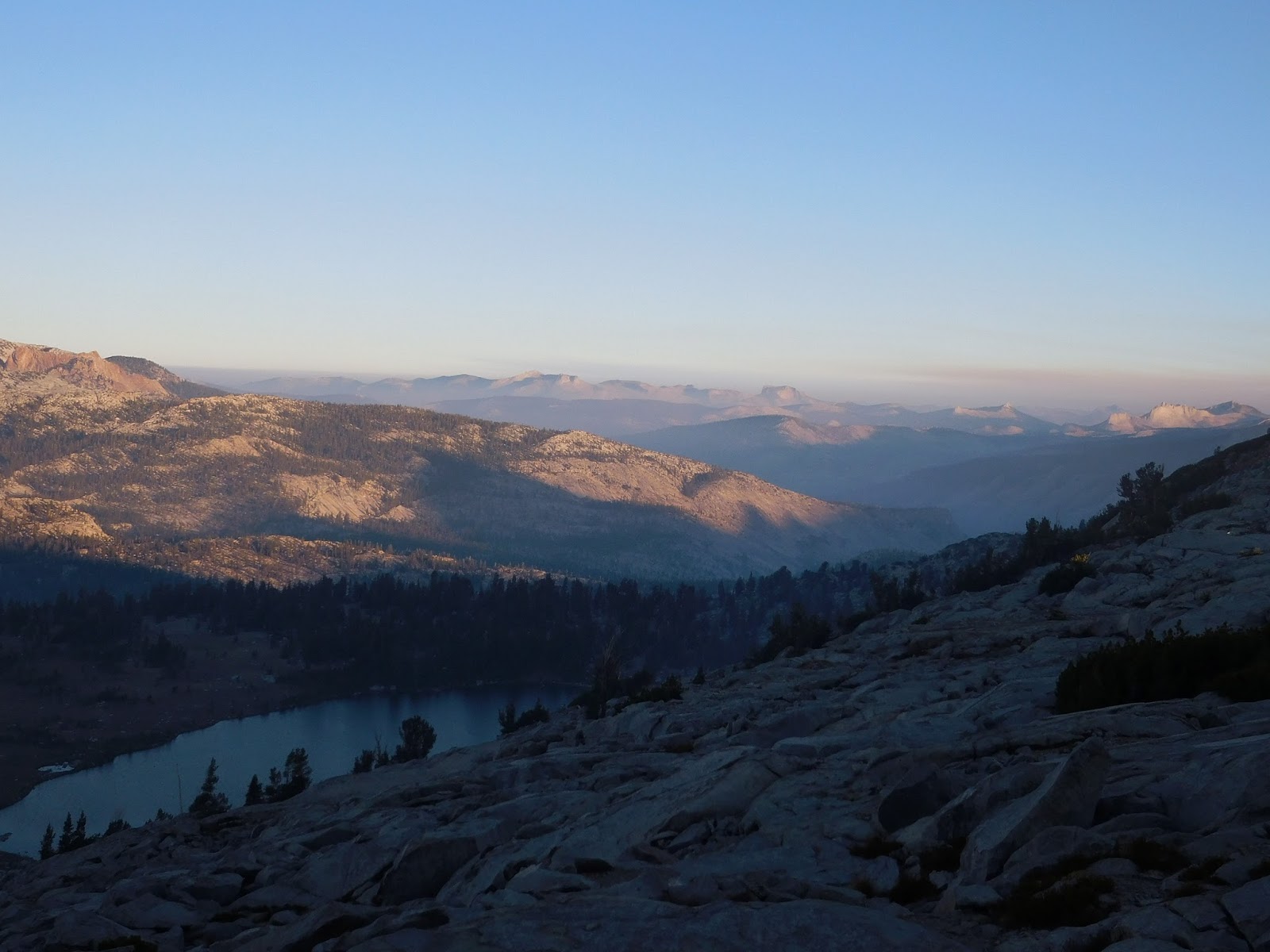
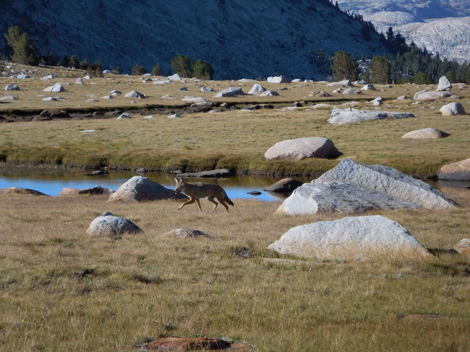
Yosemite

Vogelsang Area
This is how smokey it has been.  I think that this is of Half Dome.

Add caption


Last for sure water source before Mammoth.  Great place to swim though.

If only the mosquitoes didn't eat me alive here, I might had enjoyed the furniture.

Looking at a view near Mammoth

Red's Meadow!

Twin Lakes to Toulumne Meadows with Pictures (ie getting lost and really scared)

I'm going to post the first six days of my trip is two posts because each of the three day segments were so different and challenging.

On Wednesday (19th of August), a good friend's dad (thanks Hy!) drove me to get my permit at the Bridgeport Ranger Station and then on to the trail head at Twin Lakes.  He dropped me off and I was on my own.  The first day of hiking was very challenging but stated with about 5 miles on trail.  Then I walked up a canyon to Horse Creek Pass.  This was the start of my "off-trail" hiking and it was tough.  Climbing more or less straight up the side of a hill and walking/climbing over talus (rocks that range from the size of a small dog to the size of vans) makes it really tiring and difficult.  After making it up that pass, I descended to through a meadow (one of the best one's I've ever been through) and then went over my second pass of the day.

The only problem was that I went over the wrong one.  I didn't realize this until I got to my camping spot for the night.  After the second pass, I passed by a lake, went for a swim, and climbed up another ridge to camp.  At camp, I realized I wasn't headed in the wrong direction and between an app on my phone and my paper maps, I was able to figure out where exactly I was.

On the second day, I got myself back on my route and spent the morning climbing my third pass of the trip, Sky Pilot Col.  The whole experience of this pass was probably one of the scariest things I had ever done.  Going up the pass was like climbing up a wall that crumbles when you look at it.  The scree (essentially pea sized rocks that make you slide down the hill when you step on them) mixed with talus made it really difficult and dangerous because no hand or foot hold was "safe."  After who knows how long, I made it to the top and then was greeted by a cliff of granite.  This sight scared me more than anything I've EVER done.  I had not idea how I was going to get down because going back the way the came wasn't an option.  After giving myself a really good pep talk that I was going to be fine, I climbed over a small ridge and saw a better, but almost equally steep way down.

Thankfully, I made it down that pass with nothing worse than some rocks in my shoes and the rest of the day was pretty mellow, from the danger point of view.  It was tiring to go up the side of a Mt. Conness but my campsite was prime for Day 2.  I was able to look back at where I came from and was also by a lake.

Day 3 brought no passes but just a lot of small ridges to climb and lakes to pass around.  Mid-morning I saw a fox or coyote (I'm not sure what one) and ended up in Toulumne Meadows in Yosemite National Park.  I took the rest of the day off to give my tired and sore knees and ankles a break and to reevaluate of what route through the Sierra I wanted to take.  The Sierra High Route was fun for the first three days, but a little over my comfort level.  I'll explain more in the next post.

Start of hiking again

View of Twin Lakes

Top of the Horse Creek Pass (its the V notch)

Glacier on the side of the pass

View from the top of the pass

Meadow from the first day

Looking back towards Horse Creek Pass
View from my "second" pass.  I went down towards the lake.

View of Sky Pilot Col, the way I went up

View from top of Sky Pilot Col

Campsite from Day 2

Looking back on where I hiked through on Days 2 and 3

View of Gaylor Lakes

Is it a fox or a coyote?
Yea!  Dan's last day of work.

Tuesday, August 18, 2015

Waiting until the last minute

Tomorrow is my start day for the SHR and I feel like I have been crazily tying up loose ends before I left San Diego and as I made my final adjustments to my pack in Mammoth.  As I finished packing up my stuff in Mammoth, I found that my water filter somehow didn't quite make it into my bag.  I have no idea where the heck it is but more likely than not, it got packed away with my kitchen stuff as I was packing up my room/things yesterday.  This meant a trip to the Mammoth Mountaineering store to get another.

I also had to figure out my emergency contact device because I got my hands on it this evening.  So much for a relaxing night before my hike.

If anyone wants to follow where exaclty I am on this hike check out http://share.findmespot.com/shared/faces/viewspots.jsp?glId=0VYMQQfJLD8MOOhN4YbOQUardJiTM2Jxe
I have a fancy device that pings my position every 10 minutes and puts it on the above website.  I thought it would be a neat thing to do so here's to giving that a try.

Sunday, August 16, 2015

On the Trail Again!

The time is here again for big adventures!  In November, I will be starting nursing school and before starting, I am going to have some more fun in the outdoors by hiking the Sierra High Route (SHR), biking to Montana, and spending some time in North Carolina.  Like a few years ago, I plan on updating this blog at least once per week and sharing what interesting, strange, and fun things happen.  I will post about my biking plans after I get through my SHR hike.

You may not have heard about the SHR, so here is a brief description.  It is an approximately 200 mile trail that runs from Twin Lakes, which is near Bridgeport, CA and the northern border of Yosemite NP, to Land’s End in King’s Canyon National Park.  It is mainly parallels the more well know John Muir Trail but stays at higher elevations, mostly above 10,000 feet.  It runs through pristine high country and places few people go.


To make my trip a little more memorable and scenic, I will hike the northern two-thirds of the SHR and then branch off near Bishop Pass and take the Southern Sierra High Route (SoSHR) and end near Mt. Whitney.  The SoSHR continues along the crest of mountains north of Mt. Whitney to the summit of Mt. Whitney via the Mountaineer’s Route and then onto Cottonwood Lakes.  This portion of the trail is about 100 miles long and continues through parts of the Sierra Nevada that are better than the southern one third of the SHR.


For me, doing the SHR and SoSHR is the next logical step after hiking the Pacific Crest Trail in 2013.  More than two thirds of this trip will be off trail.  This means that I will be in areas that there are few people, not easily accessed, and more beautiful, pristine, and stunning than you find when hiking on a trail in the Sierra Nevada, but it also comes a great deal of risk.  Less people means less of a chance of seeing someone if I have any issues, navigation or injury wise.  Less access and better scenery means that it is more rugged and challenging.  Instead of plugging into my iPod and listening to my favorite podcast during the afternoon, I will be constantly looking at the map and navigating over and through the terrain, getting myself over talus and scree fields (essentially cell phone to truck sized granite that is very physically tedious to go through) and doing the occasional Class 3 scramble (this is where you climb along a rock or on the side of a mountain where there is a large drop below you).  This trail seems so exciting and like a great way to continuously improve my outdoor skills.


To help minimize my risk, I plan on taking a SPOT device.  This will allow me to let my family know that I made to camp and alert search and rescue if I have any unfortunate accidents and cannot hike myself out.  Another great thing is that it will track my progress so you can see where I am in real time (I will post a link for this once I know it).  Because I’m hiking by myself, a SPOT device is the something that will help me be safer on this backpacking trip.


In case you want to read more about the SHR or the SoSHR, here are some websites:

I start on Wednesday and hope to post an update once I get to the Valley in Yosemite!