Everyone must know by now that I have made it to the border and am no longer on the PCT. It's a good thing because I heard that the people on the PCT are getting snowstorms, cold, and winter now. I'm going to use this post to tell about my time in Washington and then post my final thoughts about the PCT later in the week.
Washington started with drama. I was staying with a friend's sister near the Washington/Oregon border and the forecast for the day I wanted to leave was rain, thunder and lightning for the next two days. This meant that I could either face the not so fun elements or stay where I was for another day.
I chose to stay where I was another night and get on the trail the next day. It was a good decision because it poured buckets in the evening and overnight and lightning and thunder was seen/heard also.
While I was able to stay dry for at least one day, I did need to get back on the trail so returned to the PCT on Sep 6th. It was really had because it was a typical Washington day, light rain all day; however, the next 8 days after turned out to be pure bliss. The weather went from crazy rainy (I was told that the storm I experienced in the beginning of September was more rain than the area had received in the month of September for the last 2 or 3 years combined) to clear and hot. The next day after the storm was perfect hiking weather and this continued for about a week.
After the Oregon border, my next stop was a place called White Pass and the 150 trail miles between these places was for the most part good. I got to hike through some amazing old growth forest in the beginning and the rain, while I wasn't excited about it, fit right in. It was amazing to look at the trees, moss, and mushrooms. One of the coolest things of Oregon and Washington was the crazy looking mushrooms I saw. They ranged from tiny to extra large dinner plate size and the colors were amazing. The were really all colors of the rainbow.
Beside the old growth forest, this section wasn't to memorable (it was very much like a "green tunnel") until the end when I went through the Goat Rocks Wilderness. Goat Rocks is so cool because you walk on high ridge lines where each side drops down at least 500 vertical feet to a small valley below. The ridges and mountains were just beautiful and reminded me of the Sonora Pass area near Bridgeport, CA. My only problem with this area was that the wind howled as I went through it. It was pretty strong and it made me nervous on some of the more sketchy areas that I had to hike through (A short section of trail here was the second place on trail that I was actually afraid I might get hurt because of some snow, a steep drop, and the wind). Goat Rocks was right before White Pass, so I ended this section well.
At White Pass, I met one of my sister's and we took a day to drive to and see Mt. Rainer National Park. It was a nice day off and really neat to see the park. Mt. Rainer is so massive and majestic it was just fantastic. This worked out well because when I got on trail the next day (Sep 11th) and walked in the shadow of Rainer, I could never see it.
The next section took me from White Pass and near Mt. Rainer into central Washington where I resupplied at
Snoqualmie Pass. This section started in the shadow of Rainer but the real highlight was the huckleberries that I found. I think I have mentioned the huckleberries before but all through Oregon and the first half of Washington, there are tons of these bushes on the side of the trail and this section had the biggest and sweetest berries. Other than that this 100 miles wasn't to exciting. It was a green tunnel more or less so I couldn't get any good views but that all stopped north of Snoqualmie Pass.
A short stop in Snoqualmie Pass included some really good curry, a stay at a really good hostel, and a really good time overall. It had been the first time I had hung out with fellow hiker off trail for a few weeks.
For the next 100 miles, Snoqualmie Pass to Skykomish, the scenery changed dramatically. Everyone told kept telling me that the Northern Cascades were really beautiful and I found this true after I got north of Snoqualmie Pass. The mountain became very rugged and almost Sierra Nevada looking and this lasted for the rest of the trip. Nothing memorable happened during these miles except some rain (which puts me in a little of a bad mood when I can't dry my stuff out) and great scenery.
At Skykomish, I stayed with some trail angels for the night and got out the next day because of the weather forcast was going to be good for the next few days. This meant that I could get to my last stop, Stehekin, without any rain. To do this, I had to hike 3 days that averaged 30 miles but it was worth not having to be in the rain.
I got to Stehekin on Saturday Sep 21st and it was by far one of the best town stops. It is on Lake Chelan, in the Northern Cascades National Park. and you can only get there via boat, hiking, or plane. The reason it is so cool is because it feels like you are traveled back to the 50's or 60's. Only 80 year round residents live there but it seems to have a mainly old trucks. Their is a fantastic bakery there also and that was the best part. I ate cinnamon rolls, sticky buns, scones, savory pastries, and danishes over the day and a half that I was in Stehekin. It was heaven but I had to leave because I only had 90 miles of trail left.
After getting my packages from the Post Office on Monday morning, I got back on trail for the last time, but it now felt like winter. Ever since Snoquolamie Pass, the weather got colder and colder and felt more winter like, but it really felt like winter after Stehekin. My last 4 days on trail were great. I had good company, the scenery was really beautiful, and I got to do a little hiking in snow. The last section is mainly between 5000 and 7000 feet and everything from 5500 feet and up had snow. This meant that going over passes and walking along ridge lines was now done in snow. It all culminated on my last night where it snowed for part of the night.
On Sep 26th, I woke up to snow on the ground and 15 miles until the Canadian border. I climbed once more through snowy passes and made it to the boarder at 12:10. I celebrated with champagne and rice crispy treats that I my sister sent me in Stehekin. There were about 6 other hikers at the border with me and we toasted and celebrated the end of our journey.
I did have to walk 9 more miles into Canada to get to the Manning Park Lodge, where I stayed once I got to Canada, but it was a breeze after 5 months of walking.
 |
| To bad I can't take it with me. |
 |
| That's right. I got to ride a moped on my trip. The best part was the kiddie backpack I used also. |
 |
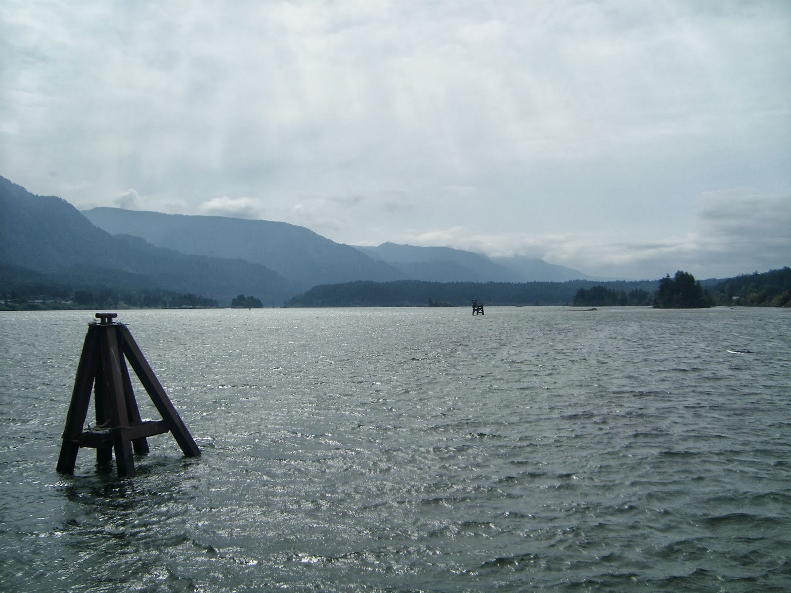
| Columbia River Gorge |
 |
| Add caption |
 |
| Mt. Adams |
 |
| Mt. Rainer from afar |
 |
| Goat Rocks and Mt. Rainer |
 |
| Goat Rocks (the trail is on the bottom left) |
 |
| Goat Rocks and Mt. Rainer. Can you find the trail. |
 |
| Mt. Rainer |
 |
| Nice lake picture |
 |
| North of Snoqualmie Pass |
 |
| North of Snoqualmie Pass |
 |
| North of Snoqualmie Pass |
 |
| North of Snoqualmie Pass |
 |
| Had to ford because the bridge is gone |
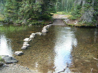 |
| Stones to cross a stream |
 |
| At the trail angels near Skykomish |
 |
| A look inside |
 |
| Northern Cascades |
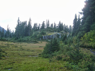 |
| Meadow |
 |
| Glacier Peak |
 |
| Hunting yurt in the mountains |
 |
| Glacier Peak |
 |
| After a night of snow |
 |
| On the last morning |
 |
| You can see how much snow I got on my last night. |
 |
| Finally! |
 |
| At last! |
 |
| So excited! |
 |
| Putting back together the place where the trail register is. |