SHR Emblem

SHR Emblem

Saturday, October 28, 2017

South of Malawi: Mt. Mulanje

On Friday July 7th, Karyn and I continued south from Blantyre via minibus to go to Mt. Mulanje, also called Mulanje Massif.  It is a huge tourist draw in Malawi and is essentially a enormous plateau made of granite.  It reminded me a lot of Yosemite Valley because it was made out of granite, has vertical rock faces, and simply looked like it could fit in there.  This is a popular rock climbing area because of the vertical walls and good quality granite.  The base of Mt. Mulanje is at about 3000 feet and the goes up 3000 vertical feet to the plateau, so most of the plateau is at 6000 feet.  The cool thing though is that there are many peaks that tower over the main plateau, and the highest point is about 9000 feet and called Sapitwa Peak.  When I say that Mt. Mulanje goes straight up, I mean it.  The trails do not switchback or meander but go the most direct route from point A to point B regardless of the elevation or grade.  We were heading there to run in a porter’s race that went up and down the mountain and to do a three day trek after the race.  

The ride to Mulanje was mostly uneventful except when the minibus driver went through a tea plantation to avoid a police checkpoint.  I really thought we would end up stuck on the dirt road, but the minibus driver masterfully navigated the deeply rutted and steep roads (Side note:  All the minibus drivers, while they may drive like maniacs, are experts and can successfully drive their vehicles on any type of road).  The weather around Mt. Mulanje is perfect for growing tea plants so the base of the mountain is covered in them.  There are many tea plantations and processing plants that surround the mountain also.  All the tea plants make the area really beautiful because the sea of light green next to the grey of the granite.

After stopping at the visitor center in the main town of the area (which is not surprisingly called Mulanje) to get more info about the race and trekking, we took motorcycles to a town called Likhubula where the race began the next day.  We checked into our hostel, organized our trek with the local forestry office (they help organize the local guides and is who you pay to camp on the mountain), and walked around to see what there was.

Mt. Mulanje is famous for its cedar trees so the local curio market sells lots of cedar things and very cheap.  I bought a medium sized hinged box for about $2.  A great deal but not the best choice in regards to deforestation.  One major issue for Malawi and Africa in general is how fast forested regions are currently being cut down (Side note:  Zambia is number 3 on the list of counties with the fastest deforestation).  Locals use trees for cooking fuel and to heat their homes and much of the wood is used to make wooden knick knacks for tourists.

After walking through the really small market and helping Karyn get a local tailor to make some skirts made of local fabrics, we headed back to the hostel to relax and prepare for the race the next day.  Along the way, we met Asa, an Israeli, who wanted to be a part of our trek up the mountain.  As the day went on, there were more and more Azungus coming into town and any potential place to spend the night was booked because everyone was here for the Mt. Mulanje Porter’s Race the next day.

I’ll talk about the race in my next post because it was such an experience.  Lots of random things happened during this fun experience.

Women caring wood down the mountain

View of Mt. Mulanje from Sapitwa Peak

Me on a motorcycle

Driving through a market town on market day

Thursday, September 21, 2017

South of Malawi: Blantyre

After we left Mushroom Farm, we did two transit days to get ourselves to Blantyre.  The first day was spent hiking down the Great Rift Escarpment to the tarmac road where we caught a surprisingly comfortable minibus to Mzuzu.  In Mzuzu, we picked up food from the store, renewed my sister’s visa, and got our bus tickets to Blantyre the next day.  We stayed at a hostel run by a South Korean woman and her American husband and ate amazing Korean food while there.
The next day we took 12 hour bus ride from Mzuzu to Blantyre.  We left at 7am sharp (there were a few people we saw trying to get the bus to stop.  Because they were late, the bus did not stop for them.  Amazing for public transport in Malawi!), got two drinks, some snacks, and had an hour break in Lilongwe.  The bus ride went well except for the driver barreling down the middle of the road.  This would not have been bad had I not sat in the front of the bus.  The other issue was the deafening music videos played over the buses TV for about 9 hours.  I watched current hip hop and R&B and really poorly produced Malawian music videos.  It became a problem when the videos went on repeat after about an hour.

Once in Blantyre, we taxied to our hostel because it had just got dark, had dinner, and went to bed.  It is exhausting to travel for such a long time even though I did absolutely nothing all day.  The next day was Malawian Independence Day (July 6) but we didn’t see any festivities, parades, or fireworks.  The plan was to transit to the Mt. Mulanje area the next day so we could run a porter’s race and do a three day trek up the mountain.  To do this, we needed to shop for food, wash our clothes, and prepare ourselves for the next week of travel.  We did this, walked around the city, and I even applied for a nursing job back in the States.  It was a nice quiet day and interesting to see another Malawian city.

Blantyre is the commercial capital of Malawi and the largest city.  It is very hilly and crowded.  I didn’t like it as much as Mzuzu or Lilongwe (the other two major Malawian cities) but this is because there isn’t much to do there.  My hope was to participate in some Independence Day celebrations or do some interesting tourist sites but I wouldn’t find any.  I was able to visit the oldest building in Malawi (it is a tourist shop/restaurant now) and a historic church but other that this, found not very much to do.  While I was disappointed about the lack of activities, Blantyre was meant as a rest day and it served its purpose because the next week was spent running, hiking, and being active.

Tribal masks we saw at the oldest building in Malawi

Historic church in Blantyre

My sister Karyn petting a girraffe

Me with a zebra

Tuesday, September 5, 2017

The North of Malawi: Nyika National Park

The other big activity we did near Livingstonia was to hike from Mushroom Farm to Chelinda Camp in Nyika NP and back over five days.  We hired a local guide, Paul, who is a park ranger in Nyika, and these five days were some of the best I had in Malawi.

On the day we got to Mushroom Farm, Paul was waiting there for us to finalize our trip and agree on a price for his guiding services.  My goal was to do this hike in 5 days but Paul was hesitant to agree to this because it takes 6 days to do normally.  After come conversation, we agreed to the hike, his fee, and a goal of 5 days if he felt we could do it.  The next day he came to the Farm and we left (after a massive 15 minute downpour).  We walked into Livingstonia where Paul got his supplies, stopped by his house for him to get his trekking equipment and gun, and through many villages.  This first day was on dirt roads and we walked straight up, over, and down the hills.  It was a fascinating day because we got a great tour of rural Malawi.  Paul saw people he knew, we saw villagers building a structure to be used by all, we crossed makeshift wooden bridges over rivers, and camped for the night at a coffee processing center.

At camp, we met a man hiking from Nyika NP to Livingstonia.  He booked this trip two years ago, flew from Lilongwe to the NP, and then did a fully guided trip.  He had a guide, cook, ranger, server, and 3 porters to carry his and all of the expeditions stuff.  We were stunned by this because we were paying $15/day for Paul and provided all our own gear and food.  This man, Chris, must have paid at least $1000 for the flight and trek.  A ludicrous amount of money for a dirt cheap adventurer like me.
This first day was pretty easy because it was slow and on easy roads but the next three days would be much more difficult.  The second day began by walking through fields of bananas and coffee and then up steep paths to get into the park.  Nyika is a plateau at about 7700 feet.  We started our hike at about 3700 feet in Livingstonia and camped the first night at about 4700 feet.  Today, we gained the rest of the altitude and would be on the plateau before lunch.

We hiked straight up the hills again and as we got higher up, the weather changed to be very misty, drizzly, and cooler (think Seattle weather).  This continued until we were on the plateau where the weather was cool and wet but midday it would turn cool and sunny.  The plateau reminded me of the rolling hills of the Channel Island off of southern California.  There were small areas covered in oak but otherwise there were short grasses covering the land.  The trail changed also and was the width of a foot.  This was frustrating to me because I had to walk like a supermodel on a catwalk to not wreck my shoes and not walk on the sides of the trail.  It was also awkward because the grasses were long enough to obscure the trail so you never quite knew where the trail was.

We ate lunch at the spot where people normally spend night two, so we continued on and camped in a gully in the middle of one of the oak thickets (see picture below).  The third day was spent walking to Chelinda Camp and seeing antelope and zebra in the grasslands around the camp.  They ran off before you could get close but it was amazing to see African animals again.  We walked around the camp and then headed back to our campsite.  The next two days were spent getting back to Livingstonia and Paul took us on a tour of the town as we walked through it.  This trek up to Nyika NP was really one of the best parts of my trip in Malawi because I got to hike, see rural Malawi, experience a place not many people go to, and get out into nature.

After we got back to Mushroom Farm, we spent the next day there and then headed off to the south of Malawi for the rest of our time there.
Ground cassava laid out to dry

Camping at the coffee processing plant

Walking on the Nyika Plateau

Our "hidden" campsite

Me posing with Paul's gun how he normally carried it 
Entering the fog 


Up on the plateau

Nyika Plateau

Chelinda Camp:  where the rich people stay

Picture looking out to Lake Malawi (Paul our guide on the right)

Paul walking through the fields

Tobacco leaves drying

Me and Paul walking the road

Coffee bean drying racks

Me and Paul

Chelinda Camp

Fog and the hills we climbed up
Millet plant

Saturday, August 19, 2017

The North of Malawi: Livingstonia

From Nkata Bay, my sister and I got ourselves to Mzuzu via a shared taxi and then to Chitimba via a minibus.  Our goal for this day’s travels was an eco-lodge called Mushroom Farm high on the Livingstonia Escarpment.  To get the Mushroom Farm, you have to walk or drive about 15km and 700m of elevation gain to get there.  We decided to walk up with our backpacks.  The first third of the walk was hot, sunny, and without shade, and starting the hike at 1pm didn’t help.  The second third of the hike is very steep with about a dozen hairpin turns to go up.  This is why the hike takes 2-3 hours or 1 hour in a car.  It is steep, curvy, and a badly maintained road.  The last third is reasonable but I was tired and it seemed very long.  Karyn was very nice and walked the whole way with two sisters we met in Nkata Bay.  They were slow and badly unprepared as they weren’t wearing socks, had short jean shorts on, minimal sun protection, and no jacket (it gets cold at night).

Mushroom Farm and Livingstonia is neat because mainly because of the natural beauty but also for the history.  It is one of the few places in Africa we visited that has some historical things you can visit.  Mushroom Farm sits right at the edge of the escarpment and you can look down 700m to the ground below and look out and see Lake Malawi and even Tanzania on the other side of the lake.  The area around Mushroom Farm is very jungle like with lots of vegetation and spiders, and we actually got a downpour of rain on morning for about 15 minutes.  It’s an eco-lodge in a beautiful place.

Livingstonia is named after David Livingstone and was, and still is, an important mission site of the CCAP (Church of Central Africa Presbyterian).  Dr. Livingstone died before he was able to start his mission, and a few years and tries later, the group he was doing this will founded Livingstonia (named after him) and the mission.  For this reason, there is a very nice stone 100+ year old church, a university, technical college, and secondary and primary school.  The missionaries began all these institutions and they are active today.  The missionaries have been so influential that when Malawi gained its independence from the UK in the 1950’s, most of the leaders were educated at one point in Livingstonia.  

The town is surprisingly small considering the historical, cultural, and educational significance of it.  With it being small, it is easy to navigate and tour the church, small museum, university, market, and stone cairn marking one of the first deaths of the mission.  The town is about 10 km from Mushroom Farm and an easier hike to get there.

Between the Farm and town, there is a 125m waterfall which is one of the largest in Malawi.  It was so unexpected to see it because while the escarpment is lush and green, there isn’t much running water on the ground.  I also found out that the slave trade use to be big in the area in the 1700 and 1800’s and local would hide behind the waterfall to escape the slavers.

Karyn and I spend a one full day here and two partial days but the big reason for the trip was to do a five-day trek to Malawi’s first national Park, Nyika NP.  I’ll talk about that part of the trip in the next post.

We camped at Mushroom Farm and this was the view!

Celebration after reaching the Farm 
In and around Livingstonia, there were they beautiful houses that had plants growing on them.


Church in Livingstonia

Church in Livingstonia

Idea of the vegetation and how well kept things are in Africa

Stone cairn

Reason for stone cairn.  There are lots of these "some camped here" monuments....random.

Waterfall

Karyn hiding from slavers

View of Lake Malawi from the top of the escarpment

I thought this house was so beautiful but the kids would not let me take a photo without people

View for Livingtonia towards the lake

One of my favorite things of Malawi is the poinsettia bushes.  They are so neat.

Pastime of all Malawians is pool.  There are pool table in nearly all town markets.

Sunday, August 13, 2017

The North of Malawi: Nkata Bay

Karyn and I met up on a Friday morning, and after some hassle of getting the rental car (another post will talk about driving in Malawi), I went to pick her up at her hostel across town.  We spent the day at the chitenge market (a chitenge is a 2 meter by 1 meter cloth that women wear over their clothes like a skirt, use to carry children on their back, use to carry things in on their head, use as a blanket, and use as a ground cover...essentially the all around useful fashion accessory), getting supplies for our journey up north, showing her about the clinic and the ABC campus, and packing our stuff for our bus ride the next day.  Two other short term volunteers at the clinic joined us, and the four of us along with some other friends went out for Ethiopian food for dinner.

The next day, we went to the monthly expat farmer’s market and then hurried to the bus station after returning our car.  We got to the station right as the “correct” bus was arriving, and I fought my way onto it to get us seats.  I was quite pleased with myself until I learned that I was on the wrong bus.  The man checking tickets didn’t notice and I didn’t look at the sign saying where the bus was going.  Thankfully some other “muzungus” (literally translated as aimless wander but is more used for any foreigner in Malawi) noticed and got me off the bus.  We watched that bus and others come and go and found the our bus would be three hours late because of a tire problem.  We waited at the nearby KFC (which also coincidentally has Malawi’s only drive through) until the bus came.  We got on and because it got to Mzuzu so late, we stayed the night at a hostel there.
On Sunday (after getting peed on by one of the hostel dogs), my sister and I took a shared taxi down to the lakeside town of Nkata Bay and to our hostel, Mayoka Village.  We got there around mid-morning and ended up camping because they were so full.  After getting ourselves sorted out, we walked into town see it, and buy some snacks.

The land surrounding Nkata Bay is very hilly (almost mountainous) and there are several bays along the edge of Lake Malawi.  This place isn’t full of sandy beaches but of rocky outcroppings along the lake.  This means you must navigate your way down to the lake if you want to swim, kayak, or SUP.  We stayed here until Tuesday morning and in the short amount of time we were here, we kayaked and SUPed around the lake, did a nice walk up the hill behind town to a remote beach, people watched the Peace Corp group and Scottish school groups that stayed at Mayoka, and enjoyed being by the water.  

In Africa, much of the travel revolves around going from one interesting place of lodging to another.  There isn’t normally a lot to do partly because the sun goes down around 1730 and because there isn’t a great amount of tourist things to do.  This means that you do about 6 hours worth of activity a day (ie walking into town, hiking, swimming, etc) and spend the rest of the time hanging out where you stay.  This makes African travel a bit slow but thankfully I had some books and podcasts to fill the time.

On Tuesday, we left Mayoka and two sister we met there joined us on our minibus trip up to Livingstonia.  For the next week or so we stayed near Livingstonia and did a five day trek of the Nyika plateau, but I’ll talk about that in the next post.

The main bay of Nkata Bay

Looks like it just needs some TLC

People moving around on the beach of the main bay

View from hike up the hill

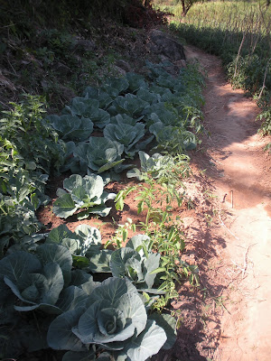
Cabbage patch on the side of the trail

Wooden dugout canoes on a beach

What most houses look like in Malawi

Looks like Santa was doing his laundry in Malawi

Looking at town and the hills behind it